Will the roads facilitate better access to the beachfront?
No. Better access to the foreshore will be achieved by reducing the traffic that crosses West Coast Highway, rather than attracting more of it. This can be done by creating a world class active and public transport system, and if necessary car parking under or above ground on the east side of the highway.
Will the roads facilitate better traffic flow along the beachfront?
No. Better traffic flow along the foreshore will be achieved by reducing the traffic that crosses West Coast Highway, rather than attracting more of it. Improved movement of people along the beachfront should give priority to people, not vehicles. We need a plan that frees the beachfront of traffic, and creates a truly people-friendly space, consistent with the MRA’s stated objective and worldwide trends in property development and urban planning.
Will the roads alleviate congestion at the intersection of West Coast Highway and Scarborough Beach Road?
No. Reducing congestion at the intersection of West Coast Highway and Scarborough Beach Road will be achieved by reducing the traffic that crosses West Coast Highway, not attracting more of it. Instead, the current MRA plan proposes to create 2 more intersections with West Coast Highway (a total of 6 in approximately 2 kilometres). This will worsen congestion, not only on the highway, but at the beachfront and along The Esplanade. And the traffic it attracts will all cross and head back to the Highway.
Will the roads provide needed access points in the case of emergency or to allow the intersection of West Coast Highway and Scarborough Beach Road to close for events?
No. There are already 4 road access points to the beachfront. Closure of this main intersection for special events will still leave 3 open to traffic, and the Scarborough Beach Road access could be used for increased and improved pedestrian, cycling, public transport and emergency access. As with many major events around the world these days, increased public transport services can be organised for these occasions. These can also be made free to incentivise use, such as the bus service that goes to Subiaco Oval for AFL football matches. Under or above ground parking developments on the east of West Coast Highway could also help address this issue if needed.
Why did the MRA override the City of Stirling’s decision to close the road reserve to the north of the Esplanade?
On 1 May 2012 the Council voted to close the Esplanade road reserve north of
Reserve St Scarborough and incorporate the land into the adjacent Class A Reserve (South Trigg Beach Reserve 46248). The Council’s reasons for closure of the 2.8 hectare road reserve were set out in a letter dated 16 May 2012:
• To maintain an ecological link into adjoining “A” Class Reserve;
• Existing flora and fauna has a continuous relationship with the current dune
structure;
• Existing entry and egress points along West Coast Hwy and Reserve St cater
for any future development;
• A “No Road” decision would bring this location into conformity with the
southern end of the Esplanade (no road).
Despite the above, during the early stages of planning the Scarborough
Redevelopment, the MRA intervened to place the road closure on hold, and in July 2014 took full statutory planning control of the area. This stopped the road closure proceeding, overriding the City of Stirling and halting the amalgamation of the road reserve and the adjacent Class A coastal reserve north of Scarborough and south of Trigg Beach car parks.
The whole of this area is environmentally significant and has been declared a Bush Forever Area under State Planning Bushland Policy 2.8.
Although we have been told on numerous occasions that this reserve is “…outside the Scarborough Redevelopment Master Plan” the MRA clearly planned to use the existing road reserve to extend the Esplanade north to West Coast Highway creating a new intersection and a major road through an environmentally sensitive and regionally important coastal dune system.
This is an example of a State Government authority stretching its powers to override a democratically elected Council and ignoring environmental protections established by the Department of Planning’s Bushland policy.
WHAT’S WRONG WITH THE PLANNED EXTENSIONS?
The MRA’s stated priority is people & beachfront, not traffic
The MRA Master Plan claims to prioritise beachfront use for pedestrians, cyclists and public transport.
“For too long Scarborough has been a massive car park; we want to make it more pedestrian friendly. We want to create a welcome place for everyone and want to see mums, dads and grandparents pushing prams.” – MRA CEO, Kieran Kinsella, in The Stirling Times, 14 June 2016
“Access, movement and parking strategies have been developed to significantly improve pedestrian and cyclist access across the site while maintaining appropriate vehicle access.” – MRA Scarborough Master Plan, Executive Summary
There’ll be less parking, but more roads
It’s a good idea to reduce parking on the foreshore. It fits the Master Plan’s stated aim of creating more space for people and the coastline we all love.
“The significant provision of beach front car-parking in itself encourages people to drive to Scarborough.” – MRA Scarborough Master Plan
If you’re looking to encourage less people to drive to Scarborough, it makes no sense to reduce car parking but build more roads.
The road extensions aren’t needed to improve traffic flow
The MRA’s transport consultant found residual capacity on major roads in the redevelopment area. They suggest significant improvements in traffic flow are possible by effective way-finding, signalling changes, design efficiencies & mode switch to active and public transport.
“Daily traffic counts show that major roads through the study area have residual capacity. Poor network performance is a product of intersection controls (including signal timings where applicable), intersection geometry and demand/turning flows during peak hours of operation.” – Arup’s Access, Movement and Parking Report for the Scarborough Master Plan
While Arup goes on to recommend the road extensions, its conclusions seem to fly in the face of much of their report, including the three international case studies cited.
These 3 international case studies cited that say it all:
- All three cities – New York, San Francisco & Toronto – removed roads, and/or re-allocated road space to people and nature, in the form of active and public transport, and ‘significant landscaping buffers’ for improved amenity, safety, aesthetic etc.
- None of these cities built more roads.
Arup’s findings also were clear on the gross lack of active and public transport infrastructure at Scarborough, and the great potential if this was fixed, to encourage sustainable transport to and at the beachfront. Confusingly, their report features all this, while their concluding recommendations are almost entirely car-related. This is all the more stark with the lack of consideration in
the report given to increasingly popular car, bike & ride share platforms.
The road extensions aren’t needed for extra parking
Likewise with parking, significant residual capacity was found. Peak demand was found to be 1,100 car bays, on the busiest summer’s day. Even with 10% loading for ‘ultra-peak’ – public holidays or major events like Australia Day – that would amount to around 1,210 car bays required.
This is still well within the MRA’s planned car parking allocation, even without the proposed additional parking on the road extensions.
- Car bays prior to redevelopment starting – 1,731
- Car bays planned for the redevelopment – 1,497
- Car bays planned for the road extensions – 282 (150 north, 132 south)
- Car bays after the redevelopment without the road extensions – 1,215
1,215 car bays mean planned parking is clear of not just the peak demand of 1,100, but the ultra-peak demand of around 1,210. And that’s without taking into account efficiency improvements and mode switch to active and public transport.
“… there is oversupply of parking assets along the foreshore”
“Logically, tighter controls on parking supply and management would facilitate some mode switch [to public transport], which is evident in other popular beachfront locations including Sydney’s Coogee and Bondi.” – Arup’s Access, Movement and Parking Report for the Scarborough Master Plan
In other words, the road extensions are proposed to include some parking, to make up about half of the parking spaces being taken out of the central Scarborough foreshore area. But if gaining a couple of hundred car spaces is the objective, there is no need to destroy the beachfront to do it.
Even if more parking was wanted, now or in future, there are plenty of alternatives to that. For example, the MRA’s transport consultant also suggested that if needed in future, parking opportunities can be developed east of West Coast Highway. This could be under or above ground parking.
Like many other river and beach front areas around Australia and the world, such as Southbank on the Yarra River in Melbourne, you can have exits from the car parks for people to walk into the main area free of traffic. This would create not only a great beachfront, but it would reduce congestion on West Coast Highway by reducing the traffic seeking to cross it.
There is no need for the road extensions, from either a traffic management or parking perspective.
It contravenes State Planning Bushland Policy 2.8
Proposing roads through two Bush Forever areas ignores state government policies which protect these regionally significant dune systems north and south of Scarborough Beach. Additionally, the State Coastal Planning Policy 2.6 Guidelines state that developments should not occur on or adjacent to mobile dunes and that new roads should be located away from the coast, be designed to avoid vegetation removal, alterations to natural topography, battering or earthworks. This policy requires developers to ask the question: “…will this road survive over the next 100 years and still provide for a coastal foreshore reserve?”
Coastal infrastructure is being damaged by rising sea levels
Roads, buildings and beaches across Australia are being swept into the ocean, due to rising sea levels exacerbating natural cycles and other human impact. Seabird is probably the most well known case in WA to date, while Fremantle’s West End is reported as becoming the ‘Venice of the South’.
Other parts of the world, like the east coast of the US, are already being flooded – not just the small Pacific islands. And this too, will only get worse, as sea levels continue to rise, which means the sorts of storm surges that are causing so much damage, eroding our coastlines, are expected to worsen.
The last thing we should do is build closer to the ocean. Particularly when The Stirling Times reports that the high tide mark is on the cusp of the dunes at Scarborough – and that wasn’t in a storm. During winter storms, chunks have been lost from the dunes at Scarborough.

“Water expert and environmental science Professor Jorg Imberger said the sea level will most likely rise about 50cm to one metre in the next 50 years and tropical weather would move south due to global warming.” –The Stirling Times, 19 September 2016
Even at the lower end of that prediction, a 50cm sea level rise, the results could be disastrous, according to the Federal government.
“A study of 29 locations in Australia found that for a mid-range sea level rise of 50 cm extreme sea level events that happened every few years now, are likely to occur every few days in 2100. On average, Australia will experience a roughly 300-fold increase in flooding events, meaning that infrastructure that is presently flooded once in 100 years will be flooded several times per year with a sea level rise of 50 cm.” –Federal Department of the Environment and Energy website, viewed 28 September 2016
Given that enormous change in flooding frequency, it is sobering to see the Peron Naturaliste Partnership, a partnership of 9 local councils between the Cities of Rockingham and Busselton, reports erosion is a far more pervasive issue than flooding. This partnership is set up to facilitate adaptation to rising sea levels in the region, and is funded by the federal government and WA Department of Transport. It has also found that an:
“Approximately 200 metre wide strip is at risk from erosion along the majority of the coastline.” –Peron Naturaliste Partnership, Coastal Adaptation Decision Pathways Project
The proposed roads at Scarborough are well within that 200 metre zone. And the City of Stirling is already footing a growing bill due to rising sea levels. Costly retention works are already occurring at Watermans Bay to ensure West Coast Drive remains intact.

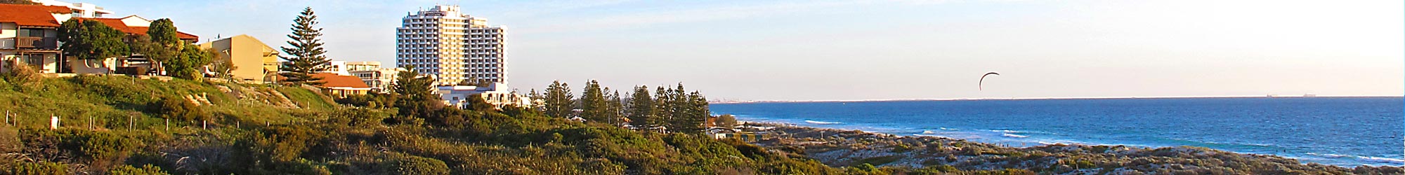
These are high conservation value sand dune systems that will be destroyed to build the roads
A range of expert surveys of the Scarborough sand dunes show they are important and regionally significant Quindalup dunes of high conservation value. Their Bush Forever status confirms this.
“This lengthy dunal system is the only location along the City of Stirling coastline where there remains a complete complex of fore dune, swale and secondary dunal systems connected to inland and significant native remnant vegetation, extending from the coastal fore dunes to the woodland for approximately two kilometres inland.” –Ecologist, Dr Judy Fisher, for the SNEC Stirling Coastal Flora Mapping Project
“Considering its location in the city this piece of bushland is in very good condition and contains a range of species characteristic of the Quindalup dune system. It provides a very good example of the type of plants found on the beach and the primary and secondary dunes. Much of this community has been cleared along the Perth coastline.” –Environmental Scientist, Judith Harvey, Wildflower Society of WA
These dunes will be largely destroyed in order to build the proposed road extensions. Imagine building another West Coast Drive in the Scarborough sand dunes. Two lanes of traffic (minimum of 7.4m), one or two lanes for parallel parking, and shared bike and walking paths, with retaining walls and embankments.
The damage to surrounding dune areas during construction will be significant and will require extensive clearing of vegetation exposing the remaining dunes to erosion and weed infestation. Even if traffic calming measures are put in place, traffic may move more slowly, but the scale of the unnecessary destruction, traffic congestion, and air, noise and light pollution, would remain the same.
Traffic congestion in Perth is the worst in the country, and getting worse
Experts and government authorities know it’s not enough to keep building more roads. The MRA Master Plan says we need to change the priorities of our transport system. But by building more roads, they would further entrench the existing priority given to the car. Congestion would keep getting worse, and the Scarborough redevelopment stands to feel the brunt of it for decades to come. Especially as the population increases and housing density is increased in Scarborough to accommodate more people.
“Can you imagine in three to four years’ time? It’s going to be completely gridlocked. Something has to happen here.” – Giovanni Italiano, Mayor of the City of Stirling, advocating for transport infrastructure including light rail through Innaloo to the coast
“Congestion is a problem faced by too many West Australians every day and it’s only set to get worse.” – RAC General Manager, Will Golsby
Build it & they will come
More roads = more traffic. The phenomenon of ‘induced traffic’ is increasingly recognised, even by roads authorities like RACWA and VicRoads. With over 100 additional cars on Perth roads every day, build more roads and they will fill them. Which means in Scarborough, we’ll end up with more congestion, not less. Including on West Coast Highway, as more traffic seeks to cross it, and all traffic from the beachfront returns to it.
“We can’t just build our way out of congestion. We need to invest heavily in public transport … and we need to encourage people to cycle or walk and make that feel as safe and as practical as we can.” – CEO of VicRoads, John Merritt
Proving the point, and the intent of the Master Plan, the MRA’s transport
consultant cited a foreshore revitalisation case study in New York where it
found that reducing parking resulted in less traffic, and as a result improved
amenity, safety and aesthetic etc.
“In particular, reduction of waterfront car parking helped to create a safer and quieter environment for people. It also reduced traffic volumes along waterfront streets and improved sight lines from the city to the water. The reclaimed space became available for amenities and pop-ups, reinforcing the new waterfront experience.” – Arup’s Access, Movement & Parking Report for Scarborough Master Plan
It’s a plan for 1950, not 2050
Cities all over the world are ripping up roads in prime locations – in cities and
by beaches and rivers – from San Francisco to Seoul (San Francisco was one
of the Arup case studies in its report for the MRA). Well known Curtin University
Professor Peter Newman has counted 22 such cities to date. And they have
been ‘rewarded with not only less traffic, but safer, more efficient cities’.
Australian cities are in on this too. The City of Yarra in inner Melbourne just won an award for its Roads to Parks Program. And spearheaded a campaign that saw a state government turfed out of office, after pushing an unpopular road project through inner city suburbs. While here in Perth, we ripped up the coastal road between City Beach and Floreat in the 1970s due to coastal erosion. Why would we now seek to put them back?
Another major trend in cities around the world is to reintroduce nature. We’ve got a spectacular natural coastline within the Scarborough Redevelopment zone. We don’t need to reintroduce or try to recreate nature, the way so many other places are having to. We already have it, and we can integrate it into an outstanding development. As one local property owner put it, you wouldn’t offer someone a 1950s phone today. Why offer us a 1950s development?
The community doesn’t want the road extensions
The community in Scarborough and beyond has repeatedly said it does not want these roads. 175 submissions received on the draft Master Plan were on the road extensions – 93% of these submissions (163 of them) were against them. Why were these submissions ignored?
What the community does want was found in the results of the MRA survey before the Master Plan. These included:
The top 3 things about the beach at Scarborough?
- Relaxed lifestyle and quality of life
- Walking and cycling paths
- Natural environment
The top 3 infrastructure improvements needed?
- Pedestrian promenades, malls
- Boardwalks
- Improved pedestrian pathways and connections
The broader Perth community also says it wants development with more public transport & safe cycling.
The ‘What Perth Wants’ report was commissioned by the Conservation Council of WA, in partnership with property developer Psaros, and the Property Council of Australia. It found that people in Perth are increasingly after eco-apartments serviced by public transport and cycling options.
This mirrors growing trends around the world, with more carless or near-carless residential developments. In fact, ‘peak car’ occurred over a decade ago – kilometres of travel per person by car have been on the decline ever since.
The Scarborough beachfront is perfectly situated to tap into these trends, but the MRA is out of step. More roads and traffic are not what people want. The road extensions risk squandering the potential of higher density living on the Scarborough beachfront, in terms of lifestyle, prosperity and the environment.
The reported top 3 priorities for Perth’s future were:
- An increase in public transport (train, light rail, buses) (95% support)
- More eco-friendly buildings that generate their own power, collect rainwater and use less energy (89% support)
- Well-designed, safer bike paths to get to work and other places (86% support)
“In particular, the research shows that high quality eco-friendly developments around transport links are strongly supported by the majority of Perth residents. For every sustainable apartment that is built, less energy is used, less waste is created, less natural bushland is destroyed and more trips are taken by public transport.” – Piers Verstegen, CCWA Director
Add to this the fact that studies worldwide show high willingness to pay (value) among users of beach and coastline.
“Users prefer “unspoiled” beach, to “spoiled” beach in study after study.” –Professor Paul Hardisty
Tellingly, there is no business case for the proposed road extensions, taking into account the loss of financial value, in addition to other value, of the loss of the conservation areas.
The state government transport plan aims to increase public transport, walking & cycling
The state government released its transport plan in July 2016, with the aim to increase the share of trips made on public transport, walking and cycling. This is consistent with the ‘What Perth Wants’ report above, and developments around Australia and the world. But it’s not consistent with the MRA’s plan to cater to increasing traffic by building new roads through Scarborough’s sand dunes.
“the MRA will work … to ensure any modifications to the local Scarborough network are in line with the recently released Perth Transport Plan for 3.5 Million People and Beyond.”-Minister for Planning, Donna Faragher MLC, via the office of Liza Harvey MLA, Deputy Premier & local Member for Scarborough, 12 September 2016
The traffic itself isn’t the half of it
Light, noise and air pollution will all increase, especially when the roads are used for late night ‘cruising’ or peak hour ‘rat-runs’. And access to the beach will be more dangerous for children and families who will be forced to cross a busy road as well as experience pollution effects and reduced amenity. All of this will be exacerbated for a beachfront that would become sandwiched between two congested roads within a confined space.
It is an unnecessary & wasteful use of at least $18m of tax-payer funds
At a time when WA is experiencing its worst debt levels ever, this is not the time to be wasting millions of dollars on an unnecessary and counter-productive road project. $18 million is the estimated cost at this stage, though we are informed it will likely be much more. And when the MRA is done, the City of Stirling’s rate payers will be left with the tab as rising sea levels require expensive retention works.
This is to say nothing of the monetary value lost from the destruction of the beachfront dunes, one of Scarborough’s and Stirling’s unique assets. We can spend substantially less on this redevelopment, with far better outcomes, by investing in better active and public transport, signage, signalling and other efficiencies.
It cements a car culture in an era of obesity and climate change
Two thirds of Australians are now overweight or obese. This is also a trend that is getting worse. The sedentary nature of car-based culture is recognised to be a major cause of this. Car-based transport is also a major contributor to climate change, especially when the infrastructure demands are taken into account.
THERE IS A BETTER WAY. WHAT CAN BE DONE INSTEAD? Our ideas here.
Download our FAQ’s here: FAQs – Beach Not Bitumen
