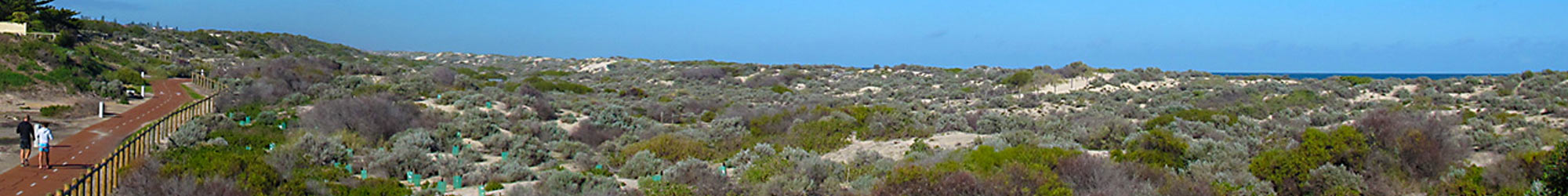
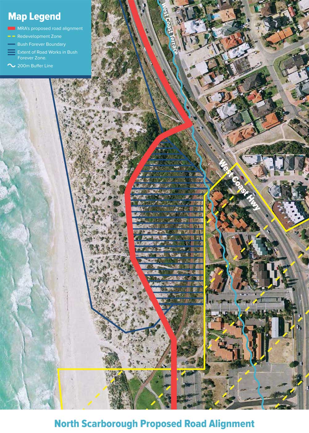
12 August 2019 Win for the Coastal Environment at Trigg Beach – No Road Ever!! The recent closure and amalgamation of the road reserve (the Esplanade north) on the beach side of West Coast Hwy at North Scarborough with the adjacent South Trigg Beach Class A Reserve 46248 is the culmination of many years of […]
Chinese property developer 3 Oceans has recently submitted a revised application to develop the old Contacio site on West Coast Highway. While Beach Not Bitumen is not campaigning on the issue, we thought it was important to provide information for those of our supporters who are concerned about the 3 Oceans proposal. The MRA is […]
Local Government elections are on now! Have your say in who represents you at the City of Stirling. You will have received your ballot papers in the mail by now. These must be returned before 6.00pm on 21 October 2017. Find out more here. The City of Stirling is responsible for managing the coastal environment […]
The City of Stirling Local Council Elections 2017 are just around the corner, with postal voting closing on Saturday 21st October. Not sure how you can vote in the election? Find out more here. We tried to cut through the ‘politics’ and get to the heart of the matter when it comes to the candidates […]